Project News
Low Cost Flood Sensors
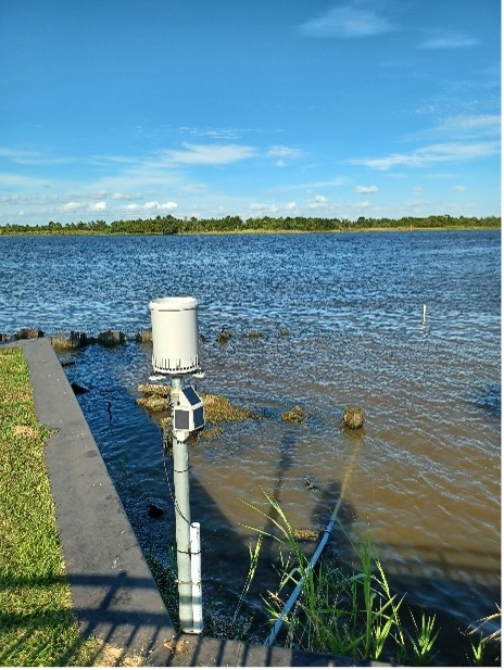
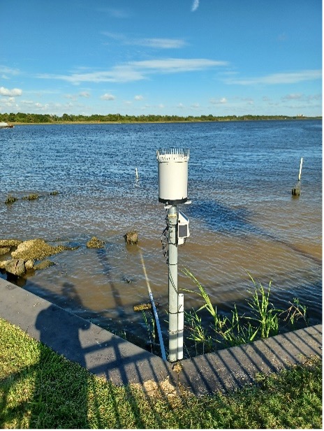
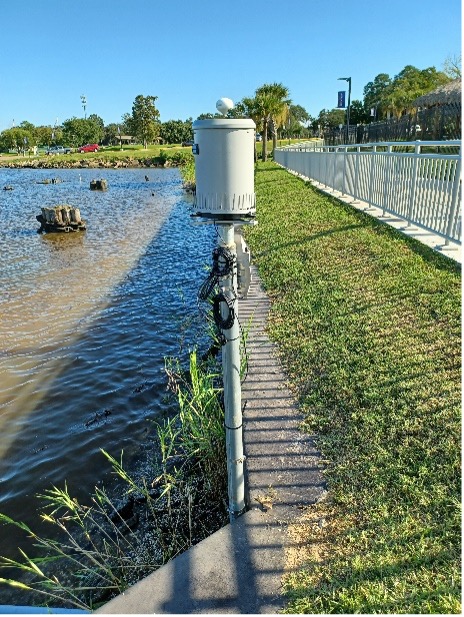
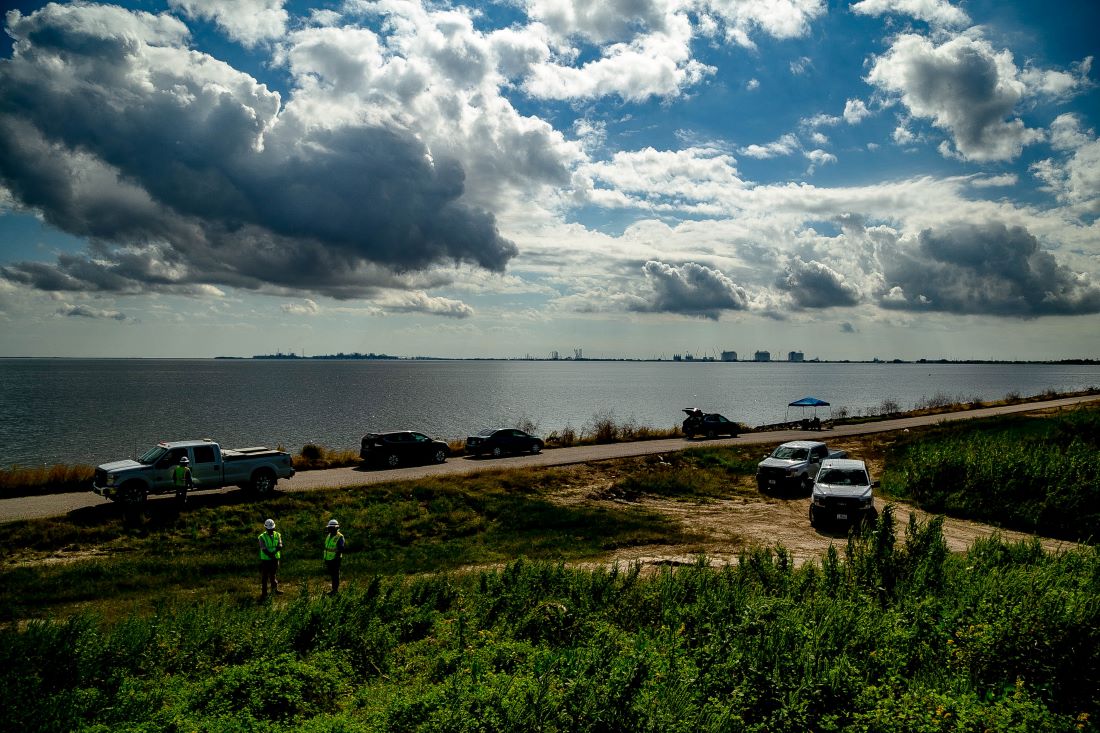
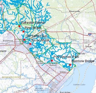
The largest ongoing project within the Flood Coordination Study is the deployment and asset management of more than 80 Low Cost flood Sensors (LCS) in a seven-county region. This is in coordination with the Department of Homeland Security Science and Technology (DHS S&T). Tasks include sensor asset management, aiding with sensor installation and technical support, and mapping high-resolution elevations near sensor locations. A survey of surrounding sensing areas is complete to establish alert thresholds and improve public data visualization within the OneRain sensor platforms.
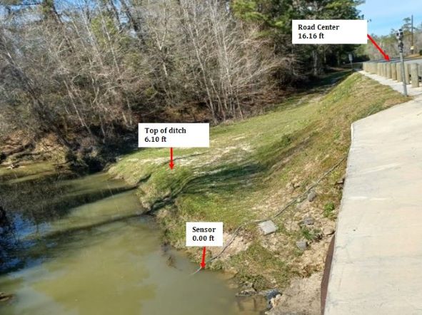
A few sensors are pictured below to show the range of sites that have been chosen for this project.
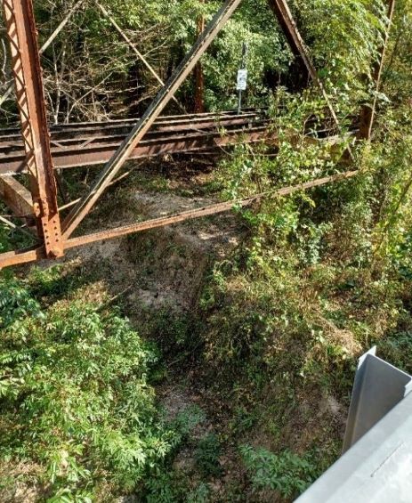
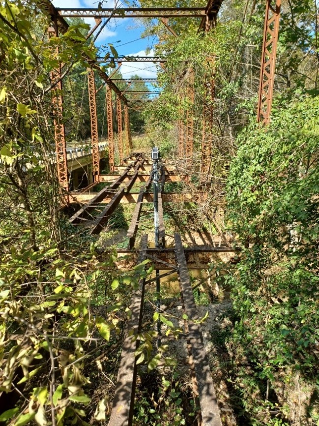
This sensor sits off Yellow Bayou in Newton off County Road 2053. As shown in the pictures, this sensor sits on a truss that hangs 30 feet over Yellow Bayou. This is 1 of the 4 sensors that are set up in Newton County.
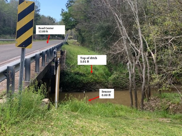
This is Flood Sensor CC02 on Whites Bayou off Hankamer Loop Road in Hankamer TX. The elevation of the sensor is 19.4 ft (MSL). The top of the ditch is 5.01 ft above the sensor, and the center of the road is 12.88 ft above the sensor.
SETx Urban Intergrated Field Laboratory
The SETx-UIFL is an external grant funded by the US Department of Energy entitled "Solutions for Communities Caught between Flooding and Air Pollution". Partners include The University of Texas at Austin, Texas A&M University, Pairie View A&M University and Oak Ridge National Laboratory. Research started in the Fall of 2022 and it's expected to last for 5 years. Updated information can be found at the grant's website SETx-UIFL Website Link
High-Frequency Radar
The High-Frequency Radar (HFR) project was with an external grant from the Texas GLO under a contract from UT El Paso. High-Frequency Radar networks provide near real-time surface current data that is applicable to coastal hydrodynamic characterizations and enables more: accurate modeling and assessment of pollutant fate and transport and water quality mechanisms. To fill HFRadar coverage gaps, UTEP et al. commissioned HFR networks in Galveston Bay and Sabine Lake. Lamar University assisted with the installation approvals and site visits.
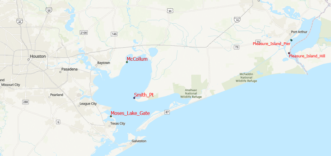
This map shows the locations of the radar networks on both Galveston Bay on the left side of the map and Pleasure Island on the right side of the map.
This displays one of the radar installation sites on Pleasure Island.
EPA Grant
The EPA has funded Dr. Qin Qian’s project titled, “Conjunctive Deployment of Distributed Stormwater Infiltration and Bioretention Infrastructures to Mitigate Flooding and Related Non-point Source Pollution in Beaumont and Port Arthur, Texas.” Two green infrastructure systems were built –– one of the two locations is on campus at Lamar University and the other is in Port Arthur. We hope to extend the research project to national infrastructure databases and build educational and outreach programs.
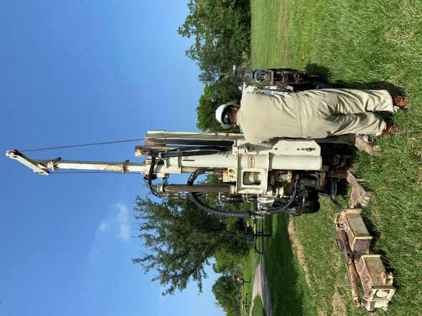
Soil boring experiment conducted by Tolunay-Wong Engineer, Inc. at Montrose Park, Port Arthur to collect 12-foot-deep soil samples.
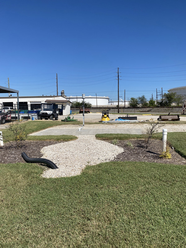
This is a Green Infrastructure System at Lamar University at the Shipping and Receiving Site at Lamar University.
NOAA Governance
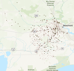
NOAA Flood Governance was a project through NOAA led by The University of Texas at Austin with other partners. The primary goal of the project was to understand how coastal communities perceive current and future flood hazards, and how local governance networks emerge and are shaped by climate and flood factors. Lamar University assisted with connections to the stakeholders and mapping in the SETx region.
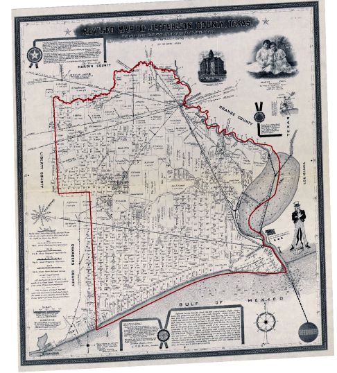
This is a land survey map copyrighted by Patillo Higgins in 1898 showing land parcels, roadways, railways, and waterways of Jefferson County. The map is overlaid with the current boundary of Jefferson County represented by a red line. The map that we have been sharing the border with the same neighbors. It also features photographs of the county courthouse and Gladys Cecil.
Historical Storm Data
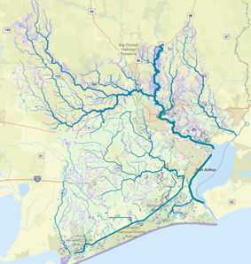
This research consisted of validating a compilation of official river stage data at two locations along with unofficial river stage data at four additional locations in between for Hurricane Harvey along the lower Neches River, a vital waterway in the United States. It also included methods to access averaged rainfall data during this period. The results compared the significant rainfall along the lower river sections during Hurricane Harvey with the affected river levels.
The 6 river gauge locations, tributaries, and sub-watershed boundaries for the lower Neches River.
High Water Mark
In recent years, there have been major storm events in the USA with record amounts of rainfall that some refer to as stalled storms. These stalled storms frequently result in flooding of urban areas which are not subject to riverine or storm surge flooding. This research focuses on using flood damage reports in conjunction with contour maps, geographical information systems, Light Detection and Ranging (LiDAR) data, photographs, and spatial averaging to develop total (high) food elevation data sets for two neighborhoods for Tropical Storm Imelda in Beaumont, Texas. When various sources of data such as insurance or Federal Emergency Management Agency damage reports, updated LiDAR elevation sets, and coordination data are readily available, this may be an economical method of estimating maximum flood elevations. High-water marks are frequently collected by various agencies as soon as possible after a flooding event, but these data sets might provide even additional information and validation many months or years post an event. Further details about the project can be found in the attached paper: High Water Mark Paper
Resilience of Sabine Neches Waterway: Capacity Restoration and Flow Analysis for Deep Draft Waterways
This research focuses on enhancing the resilience and capacity of the Sabine-Neches Waterway (SNWW)—a crucial maritime corridor for the U.S. energy sector, serving as a gateway for oil, gas, and petrochemical transportation in Southeast Texas. Ensuring its optimal functionality is vital for both regional and national economic stability. One of the primary issues is sedimentation and depth variability caused by natural sediment deposition and vessel movements, which can impede the passage of deep-draft vessels. Frequent floods contribute to additional sediment buildup and debris accumulation, further impacting the channel's capacity and safety. Moreover, the uneven distribution of vessel traffic among numerous docks leads to bottlenecks and increases the risk of accidents. To tackle these challenges, Automatic Identification System (AIS) data was utilized to reconstruct ship trajectories and analyze traffic patterns within the SNWW.
The detailed findings and methodologies of this project are documented in our published paper:
"Study on Utilization of Inland Deep-Draft Waterway Based on Ship Trajectories: Applied to Sabine-Neches Waterway"
Available at: SNWW Project
Data-driven Flood Monitoring for Transportation System in Southeast Texas
Southeast Texas, characterized by its significant petrochemical industrial complex and ongoing urban expansion, relies heavily on its transportation infrastructure for economic sustainability. However, frequent flooding due to hurricanes and tropical storms poses substantial risks to this critical infrastructure. Uniquely possessing the USGS's Elevation Derived Hydrography data, the region offers exceptional opportunities for advanced flood modeling and resiliency planning.
This project aims to develop detailed three-dimensional models of the region's drainage structures, specifically bridges and culverts, utilizing collected spatial data. By integrating these models into existing flood flow simulations or assumed flood scenarios, the research will enable an assessment of how flood impacts on the current transportation network. The initiative focuses on data processing, model development, and integration, serving as foundational steps toward comprehensive resiliency studies.
Collaboration with institutions such as the University of Texas at Austin and Oak Ridge National Laboratory will enhance the research's scope and impact. The ultimate goal is to evaluate the transportation system's capacity to withstand flood threats, identify vulnerable sections, and develop strategic interventions to improve resiliency. By contributing valuable insights and practical solutions, the project seeks to enhance the robustness of Southeast Texas's transportation infrastructure against natural disasters, thereby safeguarding the region's economic vitality.
Hydrograph of Southeast Texas Bridges and Culverts in Southeast Texas
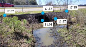
Culvert on I-10 with elevations revealed